


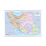
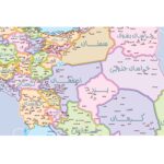


My Map of Iran is the first educational map specially designed and cartographed to meet the learning needs of elementary school students. It helps children gain a general understanding of Iran and its provinces. The map shows the locations of provinces, county centers, and major lakes across the country. It measures 70×50 cm, making it perfectly suited for students’ rooms. To ensure durability and long-term use, the map is laminated on both sides with a transparent protective layer. A plastic hanger is attached to the top and bottom for easy display. This lamination makes the map tear-resistant, easy to clean, and reusable for many years. You can even mark and erase notes on it using whiteboard markers, making it both educational and interactive.
- coverage: Iran
- Scale: 1:4.500.000
- Cover type: Laminated (plastic-coated)
- Map type: Educational wall map
- Language(s): Persian
- Persian Title: نقشه ایران من
Reviews
Clear filtersThere are no reviews yet.